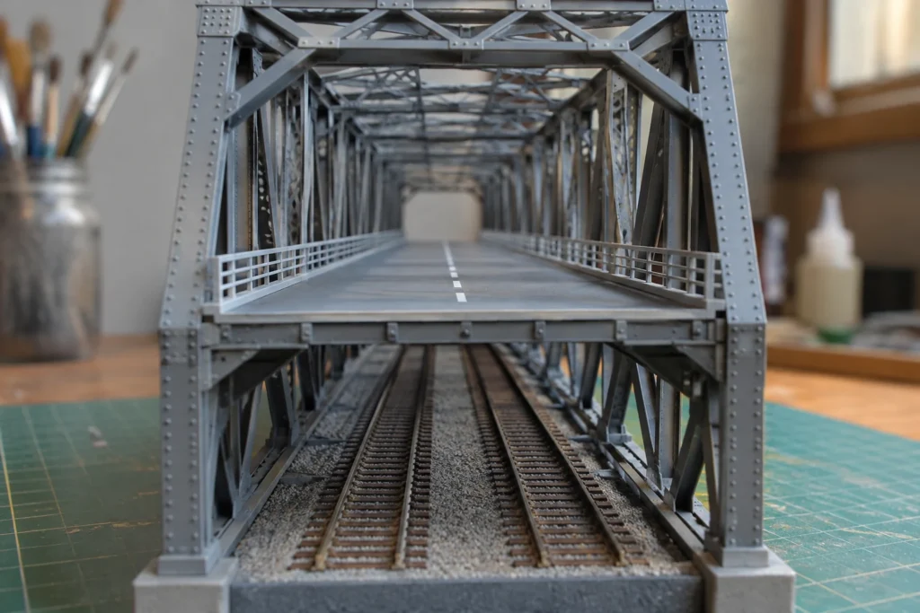
Wuhan’s Yangtze River Bridge opened in October 1957, connecting Hanyang and Wuchang. Its two decks carry different journeys: four road lanes above and two railway tracks below. That arrangement makes a city’s engineering history tangible—you can understand the design by following where the traffic goes.
Two journeys, one river crossing
The Wuhan Yangtze River Bridge gives those design questions a real structure. It opened in October 1957, linking Hanyang and Wuchang across the river. Wuhan’s official account describes a bridge 1,670.4 metres long, with four road lanes on the upper deck and two railway tracks below. (Compare traditional wooden arch bridges.)
The decks are an important part of the explanation. Road traffic and trains do not simply compete for one strip across the water. The design gives them separate levels within the same crossing, so the bridge has to accommodate different forms of movement at once.
The railway connection also reaches beyond the riverbanks. The city account places it between the Beijing–Hankou and Guangzhou–Wuchang railway routes. On a map, the bridge is therefore more than a short line joining two nearby places: it closes a gap between routes extending much farther away.
That is a useful change of scale. A person crossing may be thinking about the next stop, while the engineer has to consider how that local journey fits the network. The river, the approaches and the transport routes all belong to the same problem.
The opening date is historical; it does not provide a fresh inspection of the bridge’s condition. What the documented arrangement does show is the practical design behind a familiar city landmark. Its outline becomes much more informative once you know which journeys it carries.
Begin with the crossing
The first design question is not always what the bridge should look like. It is what needs to cross, where the route should lead and what conditions the structure must handle. A bridge for a railway and a small pedestrian crossing have different jobs even though both connect two sides.
The setting shapes the options. Designers need to understand the gap, the ground that will support the structure and the space required beneath it. A bridge over a working waterway cannot be considered only from the viewpoint of somebody standing on its deck.
That is why the line on a map matters as much as the outline in a photograph. A crossing can be strong and attractive yet connect badly with the routes at either end. The structure and the surrounding journey have to be considered together if it is to be useful.
Different users may notice different details. A driver reads the road and signs; a person on foot encounters the width and surface of the path. An inspection team needs to reach parts of the structure that ordinary users rarely see. Designing for use includes designing for later care.
Wuhan’s UNESCO profile links bridge engineering with rail design and urban planning. These are fields in which a successful solution depends on several kinds of knowledge. The visible form is one outcome of understanding materials, movement, location and the tasks the crossing must perform.
A model can help make those relationships discussable. It may show a proposed route or the arrangement of supports, while calculations and tests address questions that appearance alone cannot answer. A convincing picture is useful for communication; it is not a substitute for engineering verification.
The skyline shows the crossing’s shape. The two decks and connected railway routes explain its job. A bridge becomes more interesting when the photograph leads you to the journeys it was built to carry.
Explore next
Sources
- UNESCO Creative Cities Network: Wuhan profile
- Wuhan Municipal Government: Wuhan Yangtze River Bridge: history and deck arrangement